
Since 2007, Google has been feeding Transit information into Google Maps to help navigate around the world. Over the years, they’ve expanded to more than 18,000 cities and towns in 64 countries, across six continents, and today they’re adding more sources as well as improving the way results are displayed.
Today, Google has announced that they’re bringing on board 25+ new partners in the U.K., Netherlands, Budapest, Chicago, San Francisco, and Seattle – sorry Melbourne, not just yet.
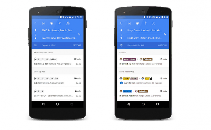
The information from their more than 100 transit partners is about to get smarter as well, with Google Maps able to display relevant journeys in a better organised list that summarises your options if you need to change your plans, or miss a connection.
I’ve spent the last 4 months travelling through Barcelona, London, Sydney, San Francisco and Los Angeles on the public transport system and Google Transit has been a life-saver, but this latest update will make it easier to do.
While these changes are nice, Melbourne still doesn’t have transit information and we’re hoping that Google will bring it soon; until then, enjoy your improved transit directions rest of the world.


